Field notes / Ancient worlds & origins
Ley lines / Earth grid
Belief / tradition
Meaning, context and sourced connections in the Great Awakening Map.
Locate on the interactive mapIn the map’s worldview
Esoteric interpretation
Ley lines turn geography into an imagined energetic anatomy of Earth. Sites and monuments are understood as meaningful points in a connected planetary pattern, rather than isolated human constructions. This helps the poster place ancient architecture within a living cosmos. Watkins’s original alignment proposal and later spiritual energy-grid interpretations should remain distinct; an alignment alone does not demonstrate an energy channel.
An interpretive reading of the poster and the sources below.
Sources for this interpretation · 2
- Creator’s English V10 poster — primary artworkBelief / proponent source
Primary artwork showing Ley lines / Earth grid; supports this reading of the map’s wording and setting, not factual verification of its claims.
- Alfred Watkins — Early British Trackways (1922)Belief / proponent source
Watkins’s original alignment proposal, which should not be conflated with later energetic-grid claims.
Illustrated field note
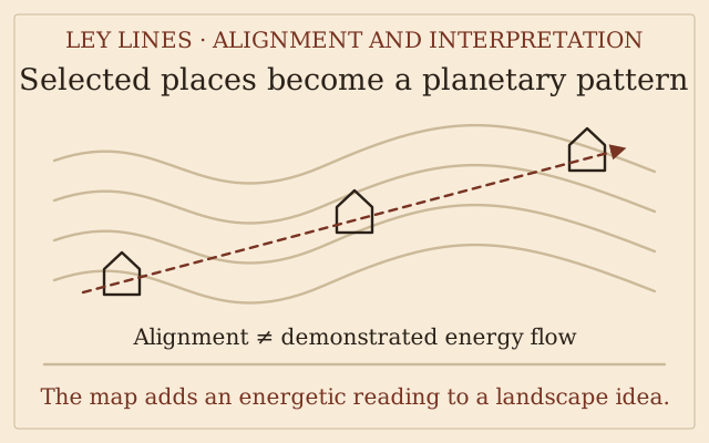
Geography becomes an imagined anatomy
 Open full-size diagram ↗
Ley lines turn isolated places into points on a meaningful planetary pattern. Watkins proposed alignments of ancient sites and trackways; later spiritual readings treat such lines as channels of Earth energy. The poster uses that energetic interpretation to place monuments within a living cosmos. A line through selected sites is not, by itself, evidence of a physical energy current.
Illustration credit & sources
Original explanatory diagram created for this map; source concepts are credited below. No source image reproduced.
Definition & background
Supposed alignments of places and monuments; esoteric interpretations describe them as a planetary energy network.
Evidence & research
Alfred Watkins' original alignment theory can be studied historically. Drawing alignments does not establish physical energy channels.
Read more
- Historic England — Watkins' ley-line archiveReference / research
- Alfred Watkins — Early British Trackways (1922)Belief / proponent source
Follow the connections
Related topics
These relationships describe what the map and its cited sources say. A connection does not establish that a claim is true.
Claim made by the poster or its sources
Stargates & portals
Ley lines / Earth grid are claimed to supply portal-network nodes → Stargates & portals
Goode’s portal-travel article explicitly proposes ley-line magnetic nodes that can be exploited for travel.
Sources for this connection
- Corey Goode: alleged portal travel through the Cosmic WebBelief / proponent source