Field notes / Cosmos & extraterrestrials
Cydonia
Real topic · speculative overlay
Meaning, context and sourced connections in the Great Awakening Map.
Locate on the interactive mapIn the map’s worldview
Esoteric interpretation
Cydonia functions as a landscape of clues about a supposed lost Martian civilization. Features interpreted as monuments invite the reader to see ancient intention behind planetary geology. Its esoteric role is an off-world counterpart to Earth’s mysteries of origins; the region’s name or proximity to other labels does not identify a particular civilization, religion or energy system.
An interpretive reading of the poster and the sources below.
Sources for this interpretation · 1
- Creator’s English V10 poster — topic and surrounding narrativeBelief / proponent source
Records the Cydonia label or surrounding claims. The explanation of its narrative role is an interpretive reading.
Illustrated field note
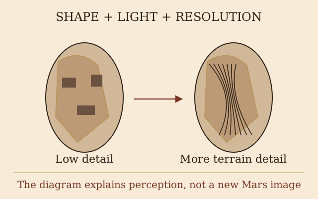
Why Cydonia became a landscape of imagined monuments
 Open full-size diagram ↗
Cydonia’s unusual-looking mesas made it fertile ground for readings of Martian terrain as deliberately designed monuments. The Face is the most famous example. This invented shading-and-detail comparison explains how a familiar appearance can arise; it does not settle every landform by resemblance or establish a Martian civilization.
Illustration credit & sources
Original explanatory diagram created for this map; source concepts are credited below. No source image reproduced.
Definition & background
A region of Mars containing eroded mesas, including the feature called the Face on Mars.
Evidence & research
Orbital images explain these landforms geologically; apparent faces and pyramids do not establish an alien city.
Read more
- ESA: Cydonia and the Face on MarsReference / research
Follow the connections
Related topics
These relationships describe what the map and its cited sources say. A connection does not establish that a claim is true.
Context / documented relationship
Mars / secret colonies
Cydonia is a region on → Mars / secret colonies
ESA identifies Cydonia as a region of Mars imaged by Mars Express.
Sources for this connection
- ESA: Cydonia and the Face on MarsReference / research
Context / documented relationship
Face on Mars
Face on Mars is a landform located in → Cydonia
NASA locates the so-called Face on Mars in Cydonia; higher-resolution images show a natural mesa.
Sources for this connection
- NASA: Face on MarsReference / research
Claim made by the poster or its sources
Egyptian pyramids
Cydonia contains alleged pyramid-like landforms → Egyptian pyramids
Pyramids appears directly beneath Cydonia.
Sources for this connection
- High-resolution Russian poster — source of the diagram’s claimsBelief / proponent source